File:Hatchet Falls Facility map.png
Revision as of 00:45, 17 June 2016 by Sojourner (talk | contribs) (== Summary == Map of the Hatchet Falls Facility (Instance) Category:Map media Category:Maps == Licensing == {{CR-fairuse}})
Size of this preview: 375 × 600 pixels. Other resolutions: 150 × 240 pixels | 577 × 923 pixels.
Original file (577 × 923 pixels, file size: 40 KB, MIME type: image/png)
Summary
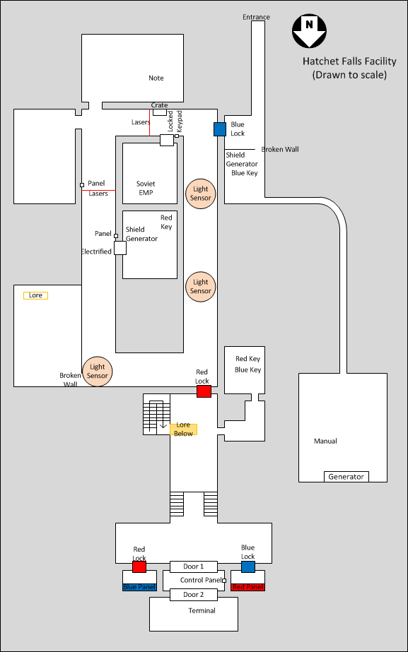
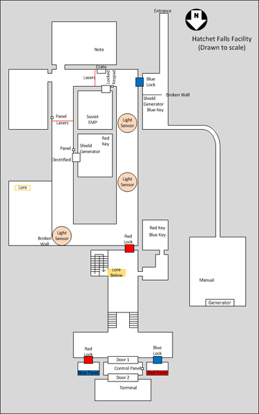
Map of the Hatchet Falls Facility (Instance)
Licensing

|
This image (or other form of media) is copyrighted, but being used under fair use guidelines. The copyright is most likely held by the original author, creator or publisher. |
File history
Click on a date/time to view the file as it appeared at that time.
| Date/Time | Thumbnail | Dimensions | User | Comment | |
|---|---|---|---|---|---|
| current | 00:45, 17 June 2016 | | 577 × 923 (40 KB) | Sojourner (talk | contribs) | == Summary == Map of the Hatchet Falls Facility (Instance) Category:Map media Category:Maps == Licensing == {{CR-fairuse}} |
You cannot overwrite this file.
File usage
The following page uses this file: